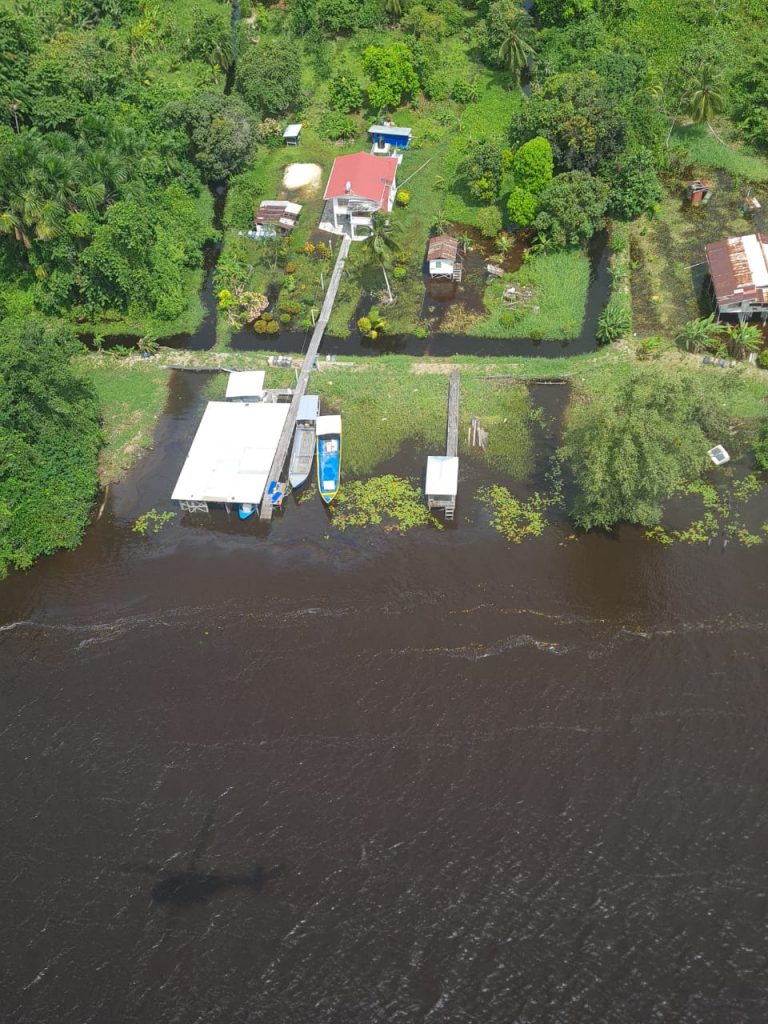
Aerial flood assessment helping CDC to plan relief
See below full statement from the Civil Defence Commission (CDC):
June 01, 2021 – The Civil Defence Commission (CDC) with support from the Guyana Defence Force (GDF) today conducted an aerial assessment of flooding in Regions 2, 3 and 7. The team led by Director General, Lieutenant Colonel, Kester Craig observed affected mining camps and households along the Cuyuni and Mazaruni Rivers.
CDC Volunteers, Julian Cadogan provided Geographic Information System (GIS) mapping to help CDC in understanding how to strategically deploy resources while Quincy Scotland provided technical support based on the impact of the flood in farming communities.

The GDF aircraft traveled approximately 80 miles from Timehri to both main rivers of Region 7, where it was observed that villages such as Issano and Hororabo should be on high alert and remain vigilant.
Miners and residents are being urged to move to higher ground to avoid being trapped in flood watrers. It was observed that some trails have become impassable posing a challenge.
Over in Regions 2 and 3, farmlands and households remained inundated with varying levels of flood waters.
The team made a short stop at Karawab, Region 2 where residents disclosed that the water level has receded from four inches high. The Regional Democratic Council (RDC) recently distributed food hampers to residents who suffered damages to property and loss of crop in the village.

The CDC has activated its Volunteer Corps which is assisting with the packing of hampers for distribution to residents in flood affected communities. Shelters have been established at Tabatinga Sports Complex, Arapaima Primary and Culvert City Nursery, Region 9, and Aroaima Nursery, Aroaima Primary Shelter and Kwakwani Primary, Region 10 to accommodate residents who are severely affected.
Persons are urged to contact their Neighbourhood Democratic Councils (NDC), RDCs and CDC’s National Emergency Management System (NEMS) to report any impacts.


